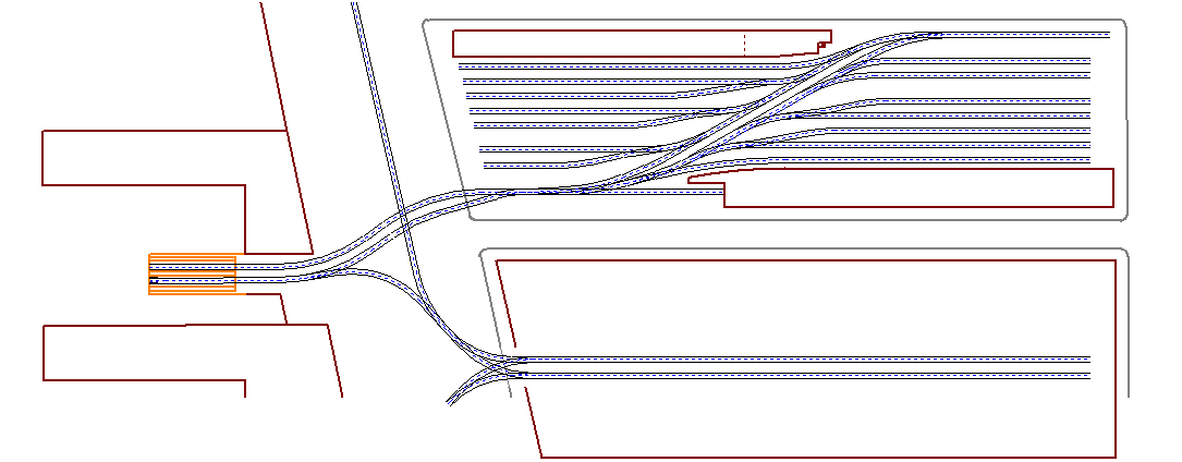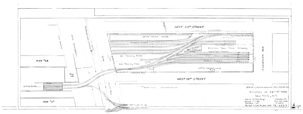
| Val-Maps or Valuation Maps are both a god send
and a royal pain. Most of the time, these Val-Maps are hand drawn and
are NOT very accurate. When you are a rivet counter this can drive you
NUTS! Tom Flagg was nice enough to send me a tiff image of the Val-Map
for 28th Street and I was able, with the help of a co-worker (Mike Sicurella),
import it into AutoCAD and scale it up to FULL Scale (1 to 1). From there
it was scale down to HO scale. In AutoCAD I was able to trace out the
trackage and create a DXF file, I then brought the drawing into CADRail
(V.8.01). I printed out the Val-map in HO Scale and preceded to layout
the drawing and checked the clearances. The main problem was track spacing,
the tracks where a scale foot to close. I then re-spaced all the tracks
in CADRail and printed the plan again! Here
are the two plans for you to look at. Keep in mind that the Val-Map
is of 1964 and the crane is gone as well as the house track into 28th
street. My Track plan put these features back. |
As Built |
Val-Map |